
Summary
- IQGeo's strongest claim is not that it displays network geography. Its real promise is that a telecom, fiber or utility operator can turn field evidence, design changes, construction progress and repair activity into an accepted network state without pushing every exception through manual reconciliation.
- The commercial upside is plausible because fiber rollout, grid modernization and field-service operations are full of waste from stale maps, old inventory systems, paper handoffs, delayed as-builts and system-to-system swivel work. But the same evidence shows that IQGeo must carry integration, training, review, migration and supervision costs that do not disappear just because the interface is mobile and geospatial.
- The company's move under KKR ownership, its Comsof and Deepomatic integrations, its Network Manager Telecom and Network Manager Electric positioning, and recent customer signals such as SaskTel and UGG all point toward a wider network-lifecycle platform. That makes the operational test sharper: can IQGeo keep the digital twin close enough to reality after contractors, offline field work, legacy GIS, customer systems and AI inspection queues start pushing against it?
- The fair judgment is positive but conditional. IQGeo is relevant where operators treat network data as an operating control surface, not a static engineering archive. It is less compelling where the buyer expects software alone to solve dirty asset records, inconsistent field incentives or unresolved authority between GIS, inventory, work management and finance systems.
The map is only the visible layer
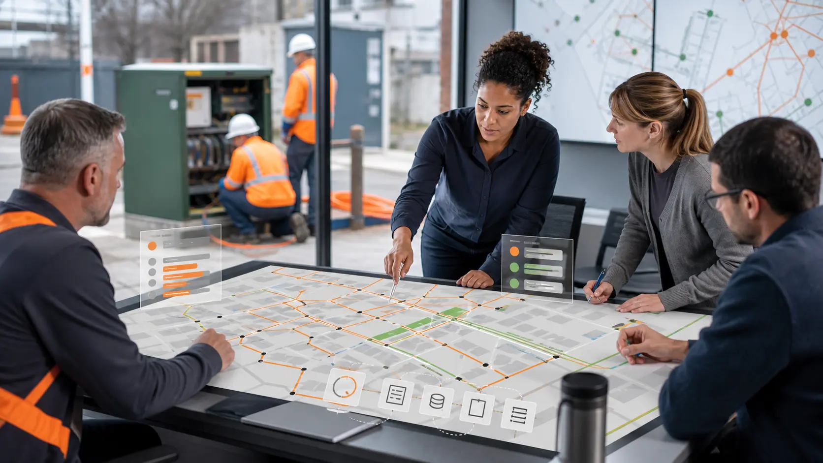
The easy mistake with IQGeo is to call it a mapping company and stop there. The more useful reading is that IQGeo sells a control layer for physical network state. Its screens may look like geographic information software, and its products do depend on geospatial data, but the customer problem is not cartography.
A telecom or utility operator needs to know whether a proposed design has become a buildable plan, whether a contractor installed what the plan expected, whether an as-built update can be accepted, whether an outage crew has enough context to restore service, and whether a later planning decision is based on the network that actually exists.
That is a harder problem than displaying assets on a map. A physical network has poles, cabinets, ducts, trenches, taps, optical network terminals, substations, switches, transformers, copper, coax, fiber, service addresses, customer orders, work tickets, photos, permits, bills of materials and financial commitments. It also has people who disagree with the data. Designers create a model from assumptions. Field crews find blocked ducts, missing poles, wrong addresses and local construction constraints. Contractors close jobs under payment pressure. Operations teams inherit partial records.
Finance and customer systems need a sellable service address before the engineering record is completely clean. Every handoff is a chance for the network model to drift away from the ground.
IQGeo's own positioning has moved toward this operating view. The company says its geospatial network management software is built for telecom, fiber and utility operators across planning, build and operations, with native mobility and integration flexibility. Its Network Manager Telecom page talks about planning, building and operating fiber and coax networks with accurate data, field tools and quality checks. Its Network Manager Electric page is even more explicit: the product is framed as geospatial work execution that connects GIS, work management and utility tasks to a live network model rather than replacing every existing system.
That distinction matters. A static GIS can remain useful even if updates arrive late. A network-state platform becomes risky if updates are late, ambiguous or poorly governed, because downstream teams begin to use the model as an authority. IQGeo's value therefore depends on the accepted change: the moment when a planned route, field redline, inspection result or repair update stops being someone's note and becomes the current state that other teams act on.
IQGeo has assembled a lifecycle platform, not a single use-case tool
The product boundary around IQGeo is broader than one field app. Network Manager Telecom is aimed at fiber, coax and hybrid network management. Network Manager Electric is aimed at utility work execution. Workflow Manager adds ticketing and task coordination around construction, operations and maintenance. Comsof Fiber, acquired earlier, brings automated planning and design. Deepomatic, acquired in 2025 and rebranded in IQGeo's product pages as NetLux AI, brings computer-vision inspection and field-documentation automation. IQGeo's service pages also describe GIS integrations, APIs, migration, training and support.
This mix is strategically coherent because network drift does not begin in one department. A bad design handoff can create drift before construction starts. A contractor's photo can create drift if it is accepted without context. A system integration can create drift if the billing system, work manager and network model each see a different status. A migration can create drift if legacy records are loaded but not reconciled. IQGeo is trying to put more of those moments inside one operating environment, or at least inside a set of connected products.
The same mix creates complexity. A buyer that only wants a mobile map viewer can judge adoption by logins and field-user satisfaction. A buyer that uses IQGeo as a network system of record needs a more demanding scorecard. It needs to know the share of field changes accepted without later correction, the time between field discovery and authoritative record update, the number of conflicts created by parallel systems, the backlog of unresolved exceptions, the rate of contractor rework, the number of jobs reopened after closeout, and the amount of support labor required to keep sync jobs, permissions, data models and workflows aligned.
IQGeo's public claims point in this direction but do not fully prove those outcomes. The company says its products can reduce planning and design effort, engineering cost and time to market. The product pages and customer stories provide examples of planning acceleration, legacy replacement and field visibility. Those are meaningful signals. They are not the same as independent evidence that a large operator's digital twin remains accurate month after month under construction pressure. The distinction is not a criticism of IQGeo alone. It is the difference between a software capability and a durable operating result.
The accepted network-state change is the right unit of analysis
The right way to test IQGeo is to follow one change through the full loop. A planner proposes a route or design. The work is sent to field survey or construction. A crew finds a difference between plan and reality. The record is updated with geometry, asset attributes, photos, notes or completion status. A reviewer, rule set or AI tool decides whether the update is good enough. The change is accepted into the network model. Other systems and teams then use it for provisioning, repair, planning, compliance, payment or customer communication.
If that loop works, IQGeo can reduce repeated survey work, delayed as-builts, duplicate data entry and manual reconciliation. If it does not work, the product can become another attractive front end sitting on top of unresolved authority problems. A field user may submit an update, but an office reviewer may still need to reconcile it against legacy GIS. A contractor may upload a photo, but the asset identifier may be wrong. A planning model may produce a faster design, but the construction environment may reveal local constraints. A work ticket may close, but a customer-service system may not receive an updated availability status.
The map then looks modern while the operating state remains contested.
This is why IQGeo's integration story is central. The company says its GIS integrations support enterprise GIS such as ArcGIS and Smallworld, bulk data loads, scheduled sync, model translation, feature sync and tile sync. Its API page describes JavaScript, Python and REST APIs for extending apps and sharing status with systems such as ServiceNow or Salesforce. Those details do not automatically prove successful deployment, but they show the company understands that network state lives across more than one application. Integration is not an optional add-on.
It is the path by which an accepted change becomes useful outside the screen where it was captured.
The risk is that every integration also creates a new place for lag. A daily scheduled sync may be enough for planning. It may be inadequate for outage response or customer activation. A bulk migration may preserve history but also carry duplicate assets, inconsistent naming and old topology mistakes. A custom API may solve one operator's workflow while creating long-term maintenance debt. A product that claims open integration has to be judged not only by connector availability, but by how cleanly conflicts are detected, assigned and resolved when two systems disagree.
Digital-twin drift is an operating condition, not a one-time defect
The term "digital twin" can make network accuracy sound like a destination: clean the data, build the model, then operate from the twin. Physical infrastructure is not that tidy. Drift is constant because the real network keeps changing. A cabinet is installed in a different location. A splice record is incomplete. A crew repairs a fault under time pressure and records the minimum required detail. A customer order drives a quick connection that later needs cleanup. A contractor works offline and syncs hours later. A permit boundary changes the build sequence. A legacy GIS still holds fields that downstream teams need.
The twin becomes useful only if the organization has a repeatable way to bring these changes back into authority.
IQGeo's product language is strongest when it recognizes this. Network Manager Electric presents a live, adaptive model that works with existing GIS and enterprise asset management rather than pretending that a GIS migration alone solves the problem. The telecom product emphasizes field tools, design versioning, migration, custom attributes, rules and equipment catalogs. The construction-management material focuses on field access to current designs, accurate as-built capture, offline use and real-time visibility. Those are exactly the points where drift either shrinks or expands.
The evidence base also cautions against assuming that software eliminates drift by declaration. Public discussion of utility GIS quality has long noted that as-built backlogs, delayed field updates and poor location accuracy can persist for months or years in traditional workflows. TM Forum's writing on digital twins and autonomous networks similarly argues that partial visibility of network assets and resources inhibits cross-domain integration, and that reliable decisions depend on accurate and current network state. These are industry-wide constraints, not IQGeo-specific flaws.
For IQGeo, this means the product's digital-twin claim should be read as a process claim. Does the platform help crews update the model at the point of work? Does it make exceptions visible quickly enough to matter? Does it allow supervisors to distinguish accepted updates from pending updates? Does it preserve version history so a rejected change does not disappear into confusion? Does it expose enough status to external systems that the accepted state is not trapped inside the geospatial application? The twin is credible only if these controls are routine.
Field exceptions decide the economics
Fiber and utility operators do not lose money only on ordinary jobs. They lose money on exceptions. The planned duct is blocked. The pole attachment requires a different method. An address is duplicated. A splice tray is mislabeled. A contractor uploads the wrong photo. A customer premises installation fails because local conditions differ from the record. A storm repair changes the network before the office model catches up. A build crew cannot sync from a weak coverage area. The exception then travels through emails, spreadsheets, phone calls, screenshots and manual review queues.
IQGeo's field-centered approach is commercially attractive because these exceptions are expensive. If field users can see the latest design, capture a redline, attach evidence, work offline and sync back into a reviewable process, the operator has a better chance of closing the gap while the crew is still near the asset. If visual AI can identify an incomplete installation or poor documentation before the technician leaves, the operator may avoid a second visit. If Workflow Manager can tie a task to network geography and connectivity, supervisors can see not just that work happened, but where it fits in the network.
The supervision cost does not vanish. It changes shape. Someone still has to decide which field changes can be accepted automatically, which require review and which must be rejected. Someone must tune workflow rules for local practice. Someone must train contractors not just to use the app, but to capture evidence that downstream teams can rely on. Someone must manage edge cases where a photo looks correct but the asset context is wrong, or where a technically correct redline creates a conflict with a plan that finance or customer operations already used.
This is the difference between automation and delegation. IQGeo can automate parts of capture, routing, validation and synchronization. It cannot remove the operator's responsibility to define authority. When a field exception conflicts with a design, who wins? When a contractor's update conflicts with a legacy inventory record, what is the escalation path? When AI flags a field image as conforming but a later audit finds a problem, how is the model corrected and how is the rule changed? Buyers should budget for those answers as part of the platform, not as temporary rollout friction.
Integration lag is the quiet cost center
The obvious costs in a network-management platform are license fees, services, migration and training. The quiet cost is integration lag: the time between a valid change in one system and a trusted update in every other system that needs it. Integration lag is not simply a technical delay. It is an organizational delay created by data ownership, workflow approvals, maintenance windows, legacy field definitions, custom reports, security controls and the fear of breaking downstream processes.
IQGeo's public materials show awareness of this problem. The company says its ETL tools can move third-party GIS data to the IQGeo platform, perform bulk loads and scheduled incremental updates, replicate source GIS data models and work with major GIS environments. Its API services describe bidirectional data sharing with third-party applications. Its 2023 German broadband contract announcement mentioned integrations with new IT infrastructure such as Salesforce and ServiceNow.
Its 2026 SaskTel announcement cited mobile-first architecture, offline field capabilities, copper support and open integration as factors in a legacy GIS replacement.
Those are significant because telecom and utility networks rarely have a single clean source of truth. The network model may sit in one system, job status in another, customer orders in another, financial commitments in another and outage operations in another. A geospatial platform can become the operational center only if it can both consume and distribute state without creating ambiguity. If it cannot, the operator may still benefit from better field visibility while continuing to pay for reconciliation staff, custom scripts and manual checks.
The commercial question is therefore not whether IQGeo has APIs. It is whether the buyer's integration program can reach a stable operating rhythm. How often do updates sync? Which changes are event-driven and which are batched? What happens when a sync fails? Is there a queue with ownership, severity and aging? Are conflicts visible to business users or hidden in technical logs? Can the platform show a crew that it is working from a stale copy? Can office teams distinguish between designed, assigned, built, inspected, accepted, rejected and exported states?
These details determine whether the platform lowers total work or simply changes where work accumulates.
AI inspection raises the bar for evidence and for governance
Deepomatic's integration into IQGeo gives the company a more ambitious field-evidence story. IQGeo says NetLux AI, formerly Deepomatic Lens, analyzes field photos, validates job conformity, supports online and offline analysis, gives real-time feedback and helps build an accurate digital twin. In July 2026, IQGeo announced an agreement with UGG to deploy NetLux AI across installation operations in Germany, with checks around optical network terminals, fiber termination points, sealing work and home connection quality. IQGeo also previewed a unified fieldworker app that would combine NetLux AI, Workflow Manager and Network Manager Telecom.
The strategic direction is clear. IQGeo wants field evidence to be captured, validated and fed back into the network model at the point of work. That is the right place to attack drift. A later office audit is often too late: the crew has left, the trench is closed, the customer expects service, and the cost of correction rises. Real-time feedback can reduce rework if the model is accurate, the image rule is relevant and the worker trusts the instruction.
The governance burden also increases. A photo classifier can reduce manual review on ordinary jobs, but it can also create false confidence if the image proves only part of the required state. A correct-looking optical terminal photo does not prove that the address, service path, customer order, splice record and downstream inventory are all right. A poor photo may trigger a rejection even when the installation itself is correct. A contractor may learn how to satisfy the image check while leaving other data weak. Supervisors may shift from reviewing every job to reviewing exception queues, model drift, disputed cases and sample audits.
That is useful, but it is not free.
The article's judgment on IQGeo therefore treats AI as an evidence amplifier, not a magic control. It can make field evidence more timely and more standardized. It can help supervisors see patterns across contractors and regions. It can support faster closeout and payment. But the accepted network-state change still needs a rule of authority: when does AI evidence update the model, when does it hold a job for review, and when does it merely advise a human? Operators that answer those questions clearly are more likely to capture IQGeo's upside.
Customer signals show demand, but not the whole denominator
IQGeo has credible demand signals. KKR completed its GBP 333 million acquisition of IQGeo in September 2024, taking the company private and framing growth around fiber rollout and grid infrastructure. IQGeo's 2024 annual report, covering the first post-take-private period, showed total revenue of GBP 50.3 million for 2024, with subscription revenue up from the prior year and recurring IQGeo product revenue at 46 percent of total revenue. The same report showed most revenue coming from the United States, with Europe, Canada and Japan also material. That mix supports the view that IQGeo is not a small experiment vendor.
Customer announcements add operational color. A 2023 German broadband win described Network Manager Telecom replacing aging GIS software for a large operator with major fiber rollout plans, including as-built documentation, mobile apps and integrations with Salesforce and ServiceNow. A 2023 US tier 1 cable announcement described replacement of a legacy network inventory system for full fiber and hybrid fiber coax networks. A 2026 SaskTel announcement described Network Manager Telecom replacing a legacy GIS environment as the operator expands fiber and 5G service across Saskatchewan.
A customer story on eir described Comsof Fiber helping accelerate FTTH planning analysis and cost estimation.
These signals matter because IQGeo's product category depends on scale. A tool that works only for small clean networks would not answer the hard problem. The public examples involve large networks, legacy environments, field users, contractors and complex rollouts. That is where accepted network-state changes have real economic value.
The missing denominator is equally important. Public materials rarely disclose the full cost of migration, the number of unresolved exceptions after rollout, the accuracy of accepted as-built updates, the rate of manual override, the number of integration failures, or the internal support burden after the first deployment phase. Vendor customer stories also tend to highlight successes. They do not give a complete view of failed pilots, slow adoptions or projects where local data cleanup consumed the expected savings. A serious buyer should treat the public evidence as a reason to investigate, not as a finished proof of return.
Software-lifecycle risk is part of the buying decision
IQGeo's move from public company to KKR-backed private ownership can help the product. Private ownership can support acquisitions, integration work, international expansion and longer investment cycles. The Deepomatic acquisition, the NetLux AI rebrand, the unified fieldworker app preview and leadership changes in 2026 all suggest a company still being actively reshaped. For customers who want a broader platform, that momentum is positive.
It also creates lifecycle risk. A network-management system is not a campaign tool that can be swapped out easily. Once field crews, planners, contractors, integration jobs, asset models and downstream systems rely on a platform, switching cost rises. That can be acceptable if the vendor roadmap remains aligned with the operator's needs. It becomes expensive if product packaging changes, acquisitions are integrated unevenly, service capacity lags sales growth, or custom workflows become hard to maintain across releases.
The risk is not unique to IQGeo. Any enterprise network system of record creates lock-in because it becomes the place where operational memory lives. The more successful IQGeo is at becoming the accepted network state, the more costly it is to move away. That makes product governance a buyer responsibility. Operators should know what data they can export, how custom attributes are represented, how version histories are retained, how APIs are supported, how offline data conflicts are resolved, how AI-derived metadata is explained, and how support severity levels map to their own operational risk.
IQGeo's training and support pages are useful evidence that the company recognizes operational adoption. Training covers network design, as-built updates, traces, configuration changes, permissions, field objects, equipment lists and labor costs. Support includes incident logging, analysis, remote diagnostics where available, and defect reporting to engineering. Those services are not peripheral. They are part of the total product because the software changes how network work is supervised. A buyer that underfunds training and support is likely to misread adoption problems as product problems, or product defects as user resistance.
The best use case is not the cleanest network
IQGeo is most interesting where the network is messy but the operator has the will to govern it. A clean small network with stable records can use many tools. A large fiber builder, utility or cable operator with legacy GIS, contractors, hybrid assets and urgent rollout pressure has the deeper need. The value appears when IQGeo reduces the distance between planned network, field reality and accepted operating record.
That does not mean IQGeo should be sold as a shortcut around data cleanup. In a messy environment, the first phase may expose more problems than it solves. Duplicate assets become visible. Conflicting address records surface. Field crews discover that old designs do not match local conditions. Contractors object to new evidence requirements. Integration owners disagree about which status field is authoritative. The product may look like it has created friction when it has actually made hidden friction measurable.
This is where management discipline matters. A buyer should define a small set of accepted-change metrics before rollout. For example: median time from field update to authoritative record; percentage of as-built changes accepted without later correction; exception backlog by age and owner; sync failure rate; rework per contractor; field adoption by workflow; number of manual touches per completed build; number of customer-service disputes linked to network record errors; and time from fault discovery to model update.
These measures do not require revealing private network data publicly, but they do require the operator to treat data quality as an operational performance metric.
IQGeo can support that discipline if its workflows, integrations and reporting are configured around the accepted change rather than around screen usage. The question is not how many users opened the app. It is how many network-state changes moved cleanly from discovery to trust.
The hard boundary between IQGeo and Deepomatic should stay clear
Deepomatic's computer-vision capability is now part of IQGeo's platform story, but it should not blur the central evaluation. Deepomatic, now represented in IQGeo's NetLux AI product line, helps validate field photos and documentation. IQGeo's core geospatial network-management problem is broader: topology, geography, design, construction, operations, inventory authority and integration across the network lifecycle.
The distinction matters because a strong visual AI result does not by itself prove a strong network-management result. A photo check can show that a particular installation stage meets a visible standard. The accepted network state also needs address accuracy, asset identity, topology, work status, serviceability, customer-system alignment and future maintainability. Conversely, a network-management deployment can have value even before AI inspection is widely adopted, if it improves field updates, design handoffs and integration governance.
IQGeo's 2026 unified fieldworker app preview is important because it tries to connect these layers. The company says the app will integrate visual AI and workflow management with the digital network twin so fieldworkers can validate work, update records and trigger next actions in one environment. That is the right ambition. The practical test will be whether the combined product reduces exception queues and contested state, not whether it adds another feature label to field work.
A practical buyer scorecard
The buyer scorecard for IQGeo should begin with operating state, not software modules. First, identify the network decisions that currently suffer from stale or disputed records: design approval, construction closeout, customer activation, fault localization, contractor payment, compliance reporting or capacity planning. Second, define the accepted-state transition for each decision: who submits, who validates, which rules apply, which systems receive the update and what evidence is retained. Third, measure the current cost of delay, rework and reconciliation. Without that baseline, ROI claims are too easy to overstate.
Fourth, separate automated checks from accepted authority. A rule can flag missing data. AI can classify a photo. A workflow can route a ticket. None of those steps automatically means the model is current. The accepted update should have a visible status, an owner, a timestamp, a version history and a path for correction. Fifth, test offline and conflict behavior early. Field crews do not always work with reliable connectivity, and the most expensive exceptions often happen outside ideal conditions.
Sixth, make integration maintenance a first-class cost. The initial connector build is not the end. Systems change, fields are renamed, workflows evolve, acquisitions add product boundaries and security policies tighten. The platform's long-term value depends on keeping the synchronization layer understandable and supportable. Seventh, treat contractor behavior as part of the system. If contractors are paid faster for complete evidence and face clear rejection rules for weak evidence, adoption can improve. If evidence capture slows them down without changing payment or dispute resolution, workarounds will appear.
Finally, review the vendor relationship as a lifecycle commitment. IQGeo's platform can become deeply embedded in the way a network operator plans, builds and repairs infrastructure. That is exactly why the product can matter. It is also why buyers should negotiate data access, support, roadmap transparency, implementation capacity and exit options with the same seriousness as the initial feature comparison.
The weak spots are measurable if buyers look early
The places where IQGeo could disappoint are not mysterious. They are the same places where any network-state platform gets tested. The first is data migration. A legacy GIS or inventory system may contain years of useful operating history, but also years of abbreviations, incomplete fields, duplicate assets, inferred topology and local workarounds. Moving that data into a modern model can make the old inconsistencies more visible. If the buyer treats migration as a one-time technical load rather than a reconciliation program, field users may inherit a cleaner interface wrapped around familiar uncertainty.
The second is role design. IQGeo can put network context in the hands of planners, supervisors, contractors and crews, but each group needs a different authority level. A planner may create a proposed design. A contractor may submit an as-built. A supervisor may accept or reject it. An operations team may need to use the accepted state immediately during a fault. If permissions are too loose, bad updates can spread. If permissions are too restrictive, crews fall back to side channels and the official record lags. The right setting is usually not obvious on day one; it has to be adjusted as the operator sees where exceptions cluster.
The third is reporting discipline. A platform can generate many dashboards without answering the central question: is the network getting more trustworthy? Buyers should resist vanity measures such as app sessions, tickets created or photos uploaded unless those measures are tied to accepted changes and downstream outcomes. Better measures are harder but more useful: accepted updates per crew, rejected updates by reason, repeated exception types, time spent waiting for review, sync failures by geography, reopened jobs after acceptance, and customer-impacting errors traced to stale records.
The fourth is change fatigue. Field teams and contractors may already be dealing with new safety apps, payment systems, customer-appointment tools and compliance forms. A geospatial workflow can improve their work only if it reduces ambiguity at the job site or makes closeout faster. If it feels like another reporting burden, adoption will be performative. Workers will enter the minimum required data, supervisors will still chase context manually, and the digital twin will keep drifting. IQGeo's mobile and AI direction is therefore promising only when paired with workflow design that makes the correct behavior easier than the workaround.
The judgment
IQGeo is a credible answer to a real infrastructure-software problem: network operators need a current, trusted, geospatially precise view of physical assets that can survive planning pressure, field exceptions and enterprise integration. The company has assembled a product set that maps well to that problem. Network Manager Telecom and Network Manager Electric address the core model. Workflow Manager addresses task execution. Comsof Fiber supports planning and design. NetLux AI adds field-evidence automation. GIS and API services acknowledge the reality that existing systems cannot simply be wished away.
The company's public evidence supports relevance more strongly than final performance. Customer announcements, annual revenue growth, KKR ownership, product expansion and current AI-field-work signals show that IQGeo is being used in the kinds of environments where network-state problems are expensive. They do not prove that every deployment produces lower total operating cost after integration, migration, training, review and support are counted. That evidence is typically private, operator-specific and dependent on implementation discipline.
The practical conclusion is conditional confidence. IQGeo should be evaluated as a system for accepting network-state changes, not as a better map and not as a generic AI story. If a buyer has the authority to clean data, redesign field workflows, govern exceptions, maintain integrations and measure accepted updates, IQGeo's platform can attack real sources of waste: stale maps, delayed as-builts, duplicate entry, truck rolls, rework and contested records.
If the buyer expects a software layer to overcome weak data ownership, contractor incentives and legacy-system politics by itself, the digital twin will drift, only with a newer interface.
The accepted change remains the core test. A design, field update or repair record is valuable only when the next team trusts it enough to act. IQGeo's opportunity is to make that trust faster, cheaper and more repeatable. Its risk is that trust is an operating practice, not a product feature.