
Summary
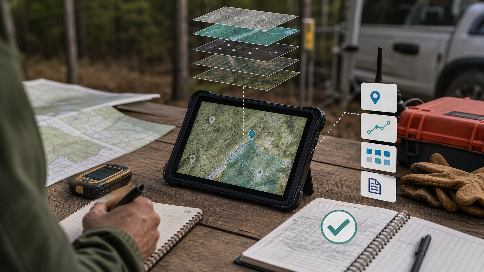
- Avenza's strongest claim is not that it sells many maps or makes offline navigation pleasant. It is that Avenza Maps, backed by MAPublisher and Geographic Imager, can turn prepared geospatial files into an accepted offline field map that a crew can use when cellular service is absent.
- The product earns its keep when map preparation, georeferencing, device provisioning, user training, field capture, and export cleanup are treated as one operating routine. If any one of those steps is casual, Avenza can become a better PDF viewer rather than a trusted field record.
- The main failure modes are known and practical: stale maps, bad coordinate reference, GPS drift, missing offline packages, device loss, export mismatch, map-license confusion, and post-trip cleanup. None are exotic, but each can erase the labour savings promised by digital field mapping.
- The commercial case is clearest for organizations that already create or procure finished map products, run repeat field visits, and need simple exportable observations. It is weaker for work that requires live database editing, survey-grade positioning, complex synchronization, or constant map revision.
The Job Is Not "Finding a Map"
Avenza is often encountered first as a map store or as an outdoor-navigation app, but that first encounter can understate what the company is being asked to do inside a professional field operation. A hiker may judge the product by whether a downloaded trail map opens without signal. A public agency, conservation team, forester, utility crew, incident team, or cartographer has a different question. Can a prepared map leave the office, survive a day away from the network, collect observations with enough context, and return as a record that another system, supervisor, or analyst can accept?
That is the accepted offline field map. It is not merely a picture on a phone. It is a bundle of map content, geospatial reference, device state, user behaviour, local storage, permissions, field notes, export formats, and office review. The file has to be the right file. The coordinate system has to mean what the office thinks it means. The map has to be current enough for the work. The user has to understand what the blue dot can and cannot prove. The data coming back has to carry enough attribution to avoid an evening of manual interpretation.
This is why Avenza is more interesting than a generic mobile app story. Its main product boundary runs across three related surfaces. Avenza Maps is the mobile field application for offline maps, GPS position, tracks, placemarks, photos, notes, attributes, geofences, and exports. MAPublisher is the Adobe Illustrator extension aimed at professional cartography, preserving georeferencing and attributes while designers prepare finished map products.
Geographic Imager brings spatial imagery tools into Adobe Photoshop, including georeferencing, coordinate-system handling, mosaicking, tiling, and export to formats such as GeoTIFF and geospatial PDF. Together, those products speak to a common weakness in field work: the office may use GIS, design tools, and formal data sources, while the field user may need something far simpler than a full GIS workstation.
The strength of that model is also its limitation. Avenza does not remove the need for map stewardship. It does not make a stale map current. It does not transform a consumer phone into a survey instrument. It does not make a PDF behave like a live enterprise geodatabase. It does not decide whether a map publisher's licence allows a particular team deployment. Its role is to make a prepared geospatial map usable, visible, navigable, markable, and exportable in a disconnected environment.
That narrower framing matters because it changes how to measure value. The convenient question is whether the app has many maps, positive ratings, and a feature list. The better question is whether a repeated field task becomes less dependent on paper packets, local memory, after-the-fact transcription, and informal file handling. Avenza is most valuable when the organization can define what counts as an accepted field record before the crew leaves the office.
The Record Starts Before the Crew Leaves Coverage
An offline map fails before the trip if the preparation routine is weak. The field user sees the failure later, often at the worst moment, but the root cause is usually upstream. The team may have loaded the wrong quadrangle. A custom PDF may have been exported without the expected geospatial reference. A GeoTIFF may be too large for the device plan. A map-store download may sit under one user's account rather than under a repeatable team process. A map may be current enough for recreation but not for a fire perimeter, protected-area boundary, utility corridor, or access-road decision.
Avenza's product literature emphasizes offline use, custom imports, GPS positioning on downloaded maps, track recording, and field data export. Those are real capabilities, but none is self-executing. Someone must decide which maps belong in the device library. Someone must decide when to replace them. Someone must confirm that the user's device has local storage, battery, operating-system compatibility, and the right subscription tier. Someone must train the user to distinguish a map that is downloaded from one that merely appeared in a recent search.
Someone must ensure that custom imports and map-store licences match the way the organization deploys the work.
That planning cost is not a defect. It is the price of turning an app into an operating record. Paper has a similar cost, but it is often hidden. Paper packets must be printed, marked, distributed, protected from weather, reconciled after the trip, and re-keyed into systems. Avenza shifts part of that burden into device and data discipline. The organization saves time only if the digital routine is easier to repeat than the paper routine it replaces.
The accepted map also has to be legible as a business object. A crew member may say "I used the Avenza map," but the supervisor needs to know which map, which version, which coordinate basis, which layer of observations, and which export. The map-store side of the product can help by giving users access to professionally prepared maps from recognized publishers. The custom-import side can help organizations deploy their own geospatial PDF, GeoPDF, GeoTIFF, or referenced image files. MAPublisher and Geographic Imager can help cartographers prepare map outputs while retaining geospatial meaning.
The value arrives when those parts form a repeatable chain.
This is also where Avenza differs from a live mobile GIS platform. A live field GIS tries to synchronize edits against a database. Avenza's stronger pattern is to take a finished or semi-finished map product into the field and let the user collect context on top of it. That can be exactly right for trail work, conservation inspection, forestry reconnaissance, emergency pre-planning, outdoor asset checks, and many public-facing field tasks. It can be the wrong center of gravity when users must edit authoritative network features, resolve conflicts across many simultaneous editors, or maintain transactional state in real time.
Acceptance, then, is a governance question. The app can display and export. The organization must define the map lifecycle. Avenza helps when the lifecycle is bounded and field-friendly. It struggles when the organization has not decided whether the field map is a reference, a note-taking surface, or an authoritative record.
Offline Availability Is Necessary, Not Sufficient
The most obvious value of Avenza Maps is offline availability. A map that is actually on the device and tied to GPS position can be useful in a canyon, on a back road, in a forest, offshore, underground near entrances, or on a rural site where coverage is unreliable. For many crews, that alone is better than a web map that stops rendering just as the user reaches the work area. Avenza's pitch is strongest in these moments because it does not depend on a continuous connection for basic map viewing and location awareness.
But offline availability is only the first gate. The map has to be the right operational surface. A field worker who opens a downloaded map can see a position dot, but that dot is only as useful as the underlying map, the device receiver, and the user's understanding of uncertainty. Public GPS guidance is clear that smartphone location accuracy varies by satellite geometry, signal blockage, atmospheric conditions, receiver quality, buildings, bridges, and trees. Under open sky, a phone may be close enough for many field records. Under canopy, near buildings, or in steep terrain, the error can matter.
High-accuracy receivers and augmentation can improve positioning, but that is a separate equipment and procedure choice.
That makes Avenza a practical field tool rather than a guarantee of ground truth. If the task is "find the right trail junction," "mark where a sign is damaged," "record the approximate path walked," or "show a crew the perimeter they are expected to inspect," phone-based positioning may be sufficient. If the task is a legal boundary, buried asset locate, engineering stakeout, cadastral survey, or compliance action that requires high positional confidence, the organization needs additional controls.
Avenza can fit into that work only as one component, often paired with high-accuracy Bluetooth GPS hardware or a separate surveying workflow.
The static-map nature of many Avenza use cases also matters. Geospatial PDFs are useful because they carry location meaning in a familiar document format. They can include layers, known coordinate systems, and measurement functions. They are also snapshots. When the underlying dataset changes, the file must be regenerated or replaced. This is not a small detail. It means map freshness is an operating responsibility. A perfect offline map from last season may be worse than a rougher but current map for a fire road, trail closure, utility access route, or land-management boundary.
The app therefore tests discipline around pre-trip checks. Is the map actually downloaded? Is the latest version on every required device? Are map-store purchases tied to recoverable accounts? Are custom maps named clearly enough that a non-specialist user can identify the right one? Is the device battery plan credible for the length of the visit? Can the user still work if the phone is replaced, damaged, or signed out of an account? Avenza reduces one kind of uncertainty, but it exposes another: whether the organization can manage offline assets at human scale.
This is where the accepted offline field map becomes a management tool. It forces the team to decide, in advance, what a valid field package looks like. Avenza's value is highest when that package is small enough to verify and rich enough to guide the work.
The Cartography Tools Matter Because Field Maps Are Made Somewhere
The mobile app is the visible endpoint, but Avenza's desktop products explain why the company has a place in professional workflows rather than only in consumer navigation. MAPublisher is built around Adobe Illustrator, adding GIS-oriented import, projection, attribute, labeling, and export functions to a design environment. Geographic Imager does the analogous work for spatial imagery in Adobe Photoshop, including georeferencing, coordinate-system handling, mosaicking, tiling, and export.
That matters because many accepted field maps are not raw GIS layers. They are designed artifacts. They need symbology, labels, legibility, inset maps, scale bars, print compatibility, agency branding, and sometimes distribution through a store or public download page. A GIS team may hold the source data, but a cartographer or communications unit may be responsible for turning it into something a firefighter, ranger, contractor, volunteer, or visitor can actually read on a phone or tablet.
MAPublisher's relevance is strongest where the map itself is a finished product. It can import common GIS formats while keeping attributes and georeferencing intact, then export print-ready maps, geospatial PDFs, web maps, or mobile-compatible packages. Geographic Imager's relevance is strongest when imagery must keep spatial meaning after editing. It can preserve reference information while allowing Photoshop-based operations that ordinary GIS users may not want to perform inside a spatial database.
This desktop-to-field story is not frictionless. It depends on Adobe licensing, workstation skills, version compatibility, file management, and the availability of staff who understand both design and geospatial accuracy. It may be an elegant fit for professional cartographers and map publishers. It may be too specialized for a small field organization that only wants to collect points and photos. The presence of MAPublisher and Geographic Imager should not be read as proof that every Avenza customer has a sophisticated cartography shop.
Instead, it shows that Avenza's best deployments have a credible path from source data to designed map to offline field use.
The boundary with Esri and other GIS platforms is important. Avenza can export data to formats that GIS tools can consume, and independent guidance shows users moving Avenza-collected GPS data into ArcGIS for analysis. That is useful interoperability. It is not the same as being a replacement for ArcGIS, QGIS, or an enterprise spatial database. Avenza can be the field-facing layer for certain tasks, especially when the core field object is a map sheet plus observations. The GIS remains the place where authoritative data is stored, joined, analyzed, governed, and redistributed.
This division of labour is not a weakness if it is explicit. In fact, it can be the reason Avenza works. Many field users do not need a full GIS editing interface. They need a reliable map, a position indicator, a way to drop a note or photo, a way to record a track, and a way to hand the result back. Avenza is strongest when the office accepts that simplicity and designs the surrounding workflow accordingly.
Field Capture Is Valuable Only If Export Survives the Handoff
Collecting a placemark in the field feels productive. The harder question is whether that placemark survives the handoff. Avenza supports export paths such as KML, GPX, CSV, and shapefile, with differences by feature type and subscription tier. The documentation distinguishes between placemarks, photos, lines, tracks, and areas, and it notes that different formats preserve different kinds of detail. That practical detail is where the value can either hold or leak away.
For a simple point list, CSV may be small and easy to inspect. For GPS devices or track-heavy work, GPX may preserve more useful detail. For photo-linked placemarks, KML or KMZ can be more appropriate. Shapefile support matters for organizations that still use shapefile as a common exchange format, especially between field users and GIS staff. None of these formats is universally best. The accepted record must define which export is expected before users start collecting data.
This is not theoretical. Public field-transfer guidance for moving Avenza data into ArcGIS describes a multi-step handoff, including export from Avenza, file movement through email or a file service, conversion of KML to a geodatabase format, and even timestamp handling to avoid display problems in ArcGIS Pro. That is a useful demonstration because it shows both the benefit and the burden. The data can move. The move is not magic.
The export handoff is also where supervision cost appears. A field user may not know why a track exported as a line changes what the analyst can do later. They may not understand why a photo appears in one export but not another. They may not notice that a layer name is ambiguous. They may send data from the wrong map or from a personal account. They may collect free-form notes when the office needs a controlled attribute schema. Avenza Pro includes tools for attribute schema and symbology management, but the organization still has to design the schema and train users to use it.
The best Avenza deployments probably look less like "everyone can mark up maps now" and more like a checklist. Use this map package. Record these features. Use these symbols. Fill these fields. Take these photos. Export in this format. Name the file this way. Upload it here. Confirm receipt before deleting local data. That may sound mundane, but mundane controls are what turn a field app into an accepted record.
There is also a recovery question. What happens if the device fails before export? What happens if the user changes phones? What happens if the map account is tied to a person who leaves? What happens if a map is deleted to save space? Avenza's account and subscription features can help, and enterprise subscription management can reduce chaos for larger teams. Still, a disconnected field tool needs a local recovery procedure. Offline work creates local state. Local state must be protected, backed up, or accepted as fragile.
In this sense, Avenza's value is not measured only by what it captures. It is measured by how much interpretation is left after export. A product that reduces paper handling but increases GIS cleanup may merely shift labour from the field to the office. A product that standardizes capture and export can reduce both.
Device State Is Part of the Map
Paper maps fail visibly. They tear, get wet, or go missing. Mobile maps fail through device state, and those failures can be less visible until the user is already away from help. Battery level, storage, operating-system updates, app permissions, Bluetooth pairing, account login, app-store access, device loss, screen readability, touch use in weather, and local file naming all affect whether the map is useful.
Avenza's enterprise pricing and feature structure acknowledges this. The product offers tiers for free, Plus, Pro, and enterprise use, with professional use requiring Pro and larger deployments moving toward team pricing, subscription management, and remote device management. That is not just packaging. It reflects the fact that the offline field map is not a one-user app install when it becomes an organizational routine. Someone has to manage devices and licences across people who may be seasonal, volunteer, remote, contracted, or moving between teams.
The unit economics have to include that administrative burden. A Pro subscription may look inexpensive beside the labour cost of a field day, a vehicle, a helicopter briefing, a missed inspection, or a manual data-cleanup cycle. At the same time, the per-device subscription is not the only cost. There may be paid map purchases, Adobe-based desktop tooling, training, device procurement, rugged cases, external receivers, mobile-device management, data review, and support time. A small team can tolerate informal practice. A large team cannot.
Device management also shapes risk. If one specialist carries one tablet, Avenza can be managed as a personal tool. If dozens or hundreds of field users need the same offline map package, the work becomes distribution. Are new maps pushed or manually downloaded? How are retired maps removed? How are map-store purchases handled? How are devices assigned? Does a crew know how to validate that the correct package is present before driving out? If not, the organization may discover that a digital map can fail in the same old way as a paper map: the right person did not receive the right sheet.
The app-store dependency is another boundary. Avenza Maps is available through iOS and Android app stores, and public listings show a large installed review base. That availability is helpful because most users can obtain the app easily. It also means mobile operating-system policy, app updates, in-app subscription rules, and device compatibility matter. For a professional team, relying on consumer app-store mechanics without a device-management plan can be risky. The app may be good, but the deployment model still needs governance.
The accepted offline field map therefore includes the device. A map that is accurate, current, and well designed is not accepted if it is trapped on a dead phone or a departed employee's account. Avenza's enterprise controls are most relevant where that risk is material. Organizations that do not need those controls should still write down their own smaller version of the same discipline.
Accuracy Is a Chain, Not a Feature
Avenza's core technical question is whether it can preserve map accuracy, offline availability, location capture, and export context when field users leave reliable connectivity. The answer is conditional because accuracy is a chain. The chain begins with the source data. It passes through map design, projection, georeferencing, file export, local download, device GPS, user interpretation, field capture, export format, and office import.
Public topographic-map guidance makes this point well. US Topo maps are only as accurate as their component data sources, and no single accuracy statement covers the whole map. USGS also notes that its maps and geospatial products are general-reference products rather than authoritative products for navigation or regulatory use. Other technical guidance on geospatial PDFs explains that they are useful static snapshots, not geospatial databases. Measurement readouts can show precise-looking numbers while the true accuracy is governed by source resolution, screen placement, and projection distortion.
Those caveats do not make Avenza unsuitable. They make it honest. Avenza can preserve and expose geospatial reference inside files. MAPublisher can maintain attributes and georeferencing in a design workflow. Geographic Imager can help preserve spatial reference while editing imagery. Avenza Maps can display a user's GPS position on a loaded map and collect exportable features. But the product cannot make the source map more current or more authoritative than it is. It cannot remove canopy or urban signal effects. It cannot make an imprecise finger tap into a surveyed coordinate.
This matters most when users over-trust the interface. A dot on a map looks authoritative. A measurement displayed to two decimal places looks exact. A shapefile export looks formal. A screenshot can circulate as if it were proof. Field leaders need to prevent that over-read. They should define acceptable uses by task. Approximate trail condition? Often reasonable. Reconnaissance photo with location context? Reasonable. Confirming a legal encroachment? Not without stronger procedure. Utility isolation or emergency command decision? Only if the map, GPS, and operating process meet the required confidence.
The better way to describe Avenza is not "accurate" or "inaccurate." It is an accuracy-preserving and context-preserving tool within a defined chain. If the chain is strong, the product can help carry map meaning into the field. If the chain is weak, the product can display weak information elegantly. That distinction is central to buyer evaluation.
The most disciplined users will likely treat Avenza outputs as tiered evidence. A placemark may be an observation, not a final asset. A track may document where someone walked, not the exact boundary of a feature. A photo-linked point may trigger review, not close it. A map package may be valid for a season, incident, project, or revision number, not indefinitely. Avenza fits well into that evidence hierarchy because it makes field context easy to collect. It should not be asked to carry more authority than the chain supplies.
Labour Savings Depend on What Happens After the Visit
The commercial case for Avenza is easy to state and harder to prove in general terms. Paper handling is expensive. Field users waste time finding the right sheet, folding it, marking it, photographing it, explaining it, and handing it back. Office staff waste time interpreting handwriting, re-entering coordinates, matching photos to notes, and recreating routes. If Avenza reduces those steps, the subscription can be cheap relative to labour.
But savings are task-specific. A team that visits similar sites every week, collects the same categories of observations, and reviews them in GIS can benefit from standardized digital capture. A conservation group managing trails, a forestry team checking stands, a fire-planning group preparing maps, or a utility contractor inspecting remote locations may see immediate value. The map is prepared once, reused many times, and improved through controlled exports.
The savings are weaker when the task is rare, vague, or unstable. If every visit needs a custom map made from scratch, the office cost may dominate. If field users collect free-text notes that still require interpretation, the app saves paper but not analysis. If the organization buys paid maps for many users without a licence plan, the map cost becomes visible. If users constantly need live updates, offline static maps can become a liability. If the office ultimately re-enters everything into another system, Avenza may only move transcription from paper to digital file cleanup.
Training is the overlooked line item. A non-specialist user can open Avenza Maps and see a position, but professional acceptance requires more: understanding map versions, imports, layers, symbols, coordinate formats, GPS uncertainty, export formats, and data retention. The amount of training depends on the task. A simple "drop a point and add a photo" routine may take little time. A schema-driven collection process with shapefile export and photo attachments takes more. A mixed team of seasonal staff and volunteers needs recurring instruction because turnover erodes tacit knowledge.
Support is another line item. Field users will ask why a map is missing, why a paid map is tied to the wrong account, why a phone shows a different location than a colleague's device, why a shapefile did not import, why a track did not preserve time, why a PDF is too large, or why a map appears rotated. Each question is solvable. Each question is also a cost. Buyers should count support tickets, not just subscription fees.
The strongest economic case appears when Avenza replaces a brittle paper-and-memory chain with a small number of repeatable digital actions. The weak case appears when Avenza is adopted as an informal app and the office remains responsible for cleaning up whatever comes back. Avenza can reduce local support labour, but only if the organization uses its features to standardize work rather than merely digitize ambiguity.
The Product Boundary With Publishers and Platforms
Avenza sits between map publishers, field users, and larger geospatial platforms. That position is commercially useful but can be confusing. The Avenza Map Store gives users access to a large catalogue of third-party and official-looking maps. Avenza Maps Pro lets organizations import their own maps. MAPublisher and Geographic Imager help professionals create maps and imagery products. Exports can feed other software.
The boundary should be drawn carefully. Avenza is not the map publisher for every map in the store. It is not the public agency behind every map's content. It is not Esri. It is not Adobe. It is not the phone's GPS manufacturer. It is not the field crew's system of record unless the organization decides to treat exported Avenza data that way. Its role is a distribution, viewing, capture, and exchange layer around geospatial map products.
That distinction protects both buyer and vendor. If a map is stale because a publisher has not updated it, the app may still be working properly. If a phone reports a poor location under dense canopy, the app may still be working properly. If a KML export needs cleanup before ArcGIS analysis, the app may still be working properly. Avenza can make these problems easier to see, but it cannot own every upstream and downstream condition.
The platform boundary also shapes substitutes. A full mobile GIS system is a substitute when the field task is live editing of authoritative data, especially where synchronization, user roles, attachments, validations, and enterprise asset history are central. A rugged GNSS data collector is a substitute when high positional accuracy is the main requirement. Paper remains a substitute when work is occasional, risk is low, or devices are not manageable. A simple folder of geospatial PDFs can be a substitute when users only need reference maps and not structured capture.
Consumer outdoor apps can be substitutes for recreation, but usually not for professional export control.
Avenza's defensible space is where a finished map matters, offline use is routine, field capture is lightweight to moderate, and export into office review is enough. It is especially plausible where cartographers already work in Adobe tools or where a publisher wants mobile distribution without building its own app. It is less defensible where the map is only a background layer for a complex data-entry application.
This middle position can be profitable because many field teams do not need the most powerful system. They need the system they will actually use. The risk is that buyers mistake simplicity for completeness. Avenza can be the right layer, but the surrounding record policy still has to exist.
Customer Signals Are Useful but Not Proof of Reliability
Public app-store ratings, customer quotes, and professional-sector pages are helpful signals. They show that Avenza Maps has a broad user base and that its offline map pattern is familiar to many people. The presence of public guides from universities, public agencies, and technical users also shows that the product has entered real field workflows. These signals should be taken seriously because field software that no one can use rarely accumulates such visible adoption.
They should not be mistaken for controlled proof. A five-star review may come from a recreational user with one map, not a public-sector team managing hundreds of devices. A customer quote about moving away from paper maps may describe a real improvement without quantifying data quality, support cost, export error rates, or total cost of ownership. A training PDF may show that a workflow is reproducible without showing that it is robust under every device, map, and staff condition.
The right reading is balanced. Public evidence supports the conclusion that Avenza Maps can be used offline, can display GPS position on downloaded or imported maps, can capture tracks and features, and can export data in common formats. Public evidence also supports the conclusion that field handoff can require format decisions and cleanup. It does not prove survey-grade accuracy, universal reliability, or automatic acceptance by downstream GIS systems.
This distinction is important for risk management. Buyers should run their own acceptance routine before treating Avenza as operationally critical. That routine should include at least one offline trip, one lost-signal scenario, one device-change scenario, one export into the office system, one stale-map rejection, one user-training check, and one map-license review. The test does not need to be elaborate. It needs to match the real task.
The more repeatable the task, the easier it is to justify that effort. If a team will use the same map package and fields every week, a day spent designing the routine can pay back quickly. If the team will use the product once a year, the setup may not be worth it. Avenza's convenience grows into enterprise value only when repetition turns small saved minutes into measurable labour reduction.
Where Avenza Wins
Avenza wins when the map itself is the field interface. That sounds simple, but it is a specific design choice. The user is not asked to navigate a complex database model. They open the map, see where they are, add a feature, record a track, attach a note or photo, and export the result. For many field tasks, that is the right level of abstraction.
The product also wins when organizations already have map-making capacity. A cartography shop using MAPublisher can prepare professional maps while preserving geospatial reference. An imagery workflow using Geographic Imager can maintain spatial meaning while producing visually refined material. Those outputs can then move to mobile users through Avenza Maps. The full chain supports a practical division between specialists who prepare the map and field users who consume and mark it.
Avenza also wins where paper logistics are painful. Fire briefings, forestry operations, conservation patrols, recreational-area maintenance, public-agency inspections, and remote utility work can involve large maps, changing access conditions, and many users who need the same reference. Reducing paper does not automatically reduce risk, but a controlled offline map library can improve readiness. Users can carry multiple maps without carrying a tube or binder. They can record where they went. They can attach observations to locations. They can return data in a form that starts closer to analysis than a marked-up sheet.
The product's pricing structure can support this use. The Pro tier is priced per device, with lower per-device prices at larger volumes, and enterprise options add subscription and device management. For organizations with expensive field labour, even modest time savings can matter. The price is not trivial for very large deployments, especially after maps, devices, training, and support are counted. Still, the cost is understandable and can be compared with printing, travel waste, data cleanup, and missed field context.
Avenza also wins by not pretending to be everything. Its best use is often as a bridge between map preparation and field reality. It accepts that many field users need offline maps more than they need a full spatial editing platform. It accepts that exported files remain part of field work. It accepts that map publishers and agencies have existing PDF and GeoTIFF practices. That modesty can be commercially powerful.
Where Avenza Struggles
Avenza struggles when the work requires live truth. If many field users are editing shared assets at the same time, and if conflict resolution, permissions, validation rules, and immediate database state matter, a static offline map plus exports may be the wrong foundation. Avenza can still provide reference maps, but the core record may belong in a mobile GIS platform or asset-management system.
It struggles when the map changes faster than the offline package can be governed. Incident perimeters, access closures, construction staging, and regulatory boundaries can change quickly. Avenza can handle updated files, but a team that cannot verify map version on every device is exposed. The product does not remove the need for distribution discipline.
It struggles when accuracy requirements are misunderstood. A phone GPS point on a geospatial PDF is convenient, not automatically authoritative. Under tree cover, near buildings, or around terrain obstacles, position can drift. Map source accuracy, datum differences, projection effects, and screen interaction can all matter. For survey, legal, engineering, or safety-critical work, Avenza needs to be paired with stronger instruments and procedures or kept out of the final authority chain.
It struggles when export is treated as an afterthought. The office may receive a pile of KML, GPX, CSV, shapefiles, photos, and notes with inconsistent names and unclear provenance. That can be better than paper, but it can still be costly. The organization must standardize layers, attributes, feature types, and file naming. Without that, Avenza may create more digital fragments than the office can absorb.
It also struggles when the buyer thinks the Map Store solves governance. The Map Store is useful, but professional use needs map provenance, licence clarity, update policy, and account recovery. A map available for purchase is not necessarily the right map for an operational task. A map that looks authoritative may still need verification against the organization's own standard.
Finally, Avenza can struggle in organizations that lack a map owner. The product sits between field users and geospatial specialists. If neither side owns the workflow, errors fall through the gap. The accepted offline field map needs an accountable owner who can say which maps are valid, which exports are accepted, and what users should do when something goes wrong.
The Investment Case Is Operational, Not Decorative
Avenza's commercial value is not in making maps look modern. It is in reducing the number of times an organization has to reconstruct field reality after the fact. If a crew can leave with a validated map package, work without signal, collect structured observations, return exportable data, and avoid re-keying, the value is concrete. If the app is merely a nicer way to view PDFs, the value is smaller.
The investment case should therefore be built from the repeated task. Count how often crews go out. Count how long it takes to prepare paper or ad hoc files. Count how often users arrive with the wrong map. Count how often observations are lost, unclear, or re-entered. Count how many office hours are spent cleaning notes and matching photos. Count the cost of training and support. Then compare that with subscriptions, maps, devices, desktop tooling, and governance.
For some organizations, the answer will be obvious. A field season with recurring routes, shared maps, and structured observations can justify Avenza quickly. For others, the answer will be marginal. A small group that rarely leaves coverage or already uses a live GIS platform may not need another layer. A team that requires high-accuracy data may need specialized GNSS equipment more than a map app. A publisher may value the store and mobile format more than field-data capture.
Avenza should be bought where its specific strength matches the task: accepted offline map use with enough field capture to matter and enough export control to preserve context. It should not be bought as a vague digital-transformation gesture.
Judgment
Avenza Software Inc. is best judged by whether it can help an organization produce an accepted offline field map. On the public evidence, the product family has the right ingredients: offline mobile map use, GPS position on downloaded or imported maps, track and feature capture, photos and notes, export formats, professional subscriptions, enterprise device management, cartographic preparation tools, and spatial-imagery tooling. It also has visible public adoption and independent workflow references showing that data can move from Avenza into GIS analysis.
The caveats are equally clear. Accuracy is inherited from source data, map preparation, device positioning, and user procedure. Geospatial PDFs are useful but static. Smartphone GPS is not survey-grade by default. Exports require choices and sometimes cleanup. Map licences and account management matter. Device state is part of the field record. The product does not remove the need for a map owner.
That makes Avenza a disciplined tool for organizations that know what field record they want. It is most convincing where crews need prepared maps outside coverage, where the map itself is the main interface, where field observations are lightweight enough for export-based handoff, and where reduced paper handling offsets subscription, training, map, and support costs. It is least convincing where live database state, high-precision measurement, or complex multi-user editing is the central requirement.
The accepted offline field map is a practical, repeatable standard. If Avenza helps a team meet it, the product can be valuable. If the team cannot define it, Avenza will not define it for them.